buses.appNew Plymouth public transport
Loading 3D view…

New Plymouth Guide

New Plymouth Coastal Walkway

New Plymouth

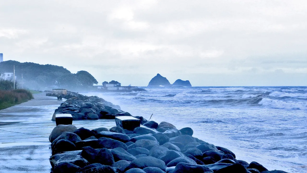
A paved path for walking and cycling that runs for about 13 kilometres along the Tasman Sea coast from Port Taranaki through central New Plymouth to Bell Block, passing Len Lye's Wind Wand.

How to get there by public transport

Lines stopping nearby

Plan a route to “New Plymouth Coastal Walkway”

From your location or a typed address — the route is drawn on the 3D map above.

Loading planner…

New Plymouth Coastal Walkway — New Plymouth
New Plymouth Coastal Walkway · Gonzalobaeza / CC BY-SA 3.0 (Wikimedia Commons)

What it is

The walkway was built in 1999 as a foreshore path of about 7 kilometres and has since been extended several times: in 2010 by about 3 kilometres, in 2014 to Tiromoana Crescent in Bell Block, and in 2016 with a link to State Highway 3. It is paved, level for most of its length and shared by walkers, runners and cyclists, with sea walls, beaches and parks along the way.

Near the city centre stands the Wind Wand, a 48-metre kinetic sculpture designed by Len Lye that sways in the wind and has a red sphere lit by LEDs at night; it was opened on 1 January 2000. Further east, the Te Rewa Rewa Bridge over the Waiwhakaiho River, opened in 2010, frames a view of Mount Taranaki and has won international awards.

Getting there by bus

This section of the walkway, west of the city centre, is reached from St Aubyn Street. Route 1 (Moturoa) stops at St Aubyn Street (near 411) Devon Int (stop 1305), about 290 metres away, together with the Saturday Orbiter 10B, and on the opposite side at St Aubyn Street (opposite 381) Devon Int (stop 1335), about 310 metres away, with the Saturday Orbiter 10A.

Routes 2 (Whalers Gate) and 3 (Lynmouth/Marfell) stop on Devon Street West (stops 1138 and 1128), about 620 to 650 metres from the shore. The Wind Wand is a walk of about 20 minutes east along the path towards the city centre.

Frequently asked questions

How do I get to New Plymouth Coastal Walkway by public transport?

The nearest stops are St Aubyn Street (near 411) Devon Int, St Aubyn Street (opposite 381) Devon Int, St Aubyn Street (near 446). Open any of them to see the lines that stop there, or use the Journey Planner for a route from your location to New Plymouth Coastal Walkway.

What is the nearest stop to New Plymouth Coastal Walkway?

St Aubyn Street (near 411) Devon Int (stop code 1305), about 290 m from New Plymouth Coastal Walkway. On the stop page you can see all the lines that stop there and live arrival estimates.

Where is New Plymouth Coastal Walkway located?

New Plymouth Coastal Walkway is in New Plymouth. You can see its exact location and a 3D view at the top of this page.

How do I get to New Plymouth Coastal Walkway from another part of the city?

Open the Journey Planner, enter your origin (an address or a stop) and New Plymouth Coastal Walkway as the destination — you will get the best routes with lines, transfers and departure times based on the timetable.

Other landmarks

Photos: Wikimedia Commons (free/licensed) · 3D view: MapLibre + OpenStreetMap.