buses.appFeldkirch public transport
Loading 3D view…

Feldkirch Guide

Katzenturm

Feldkirch

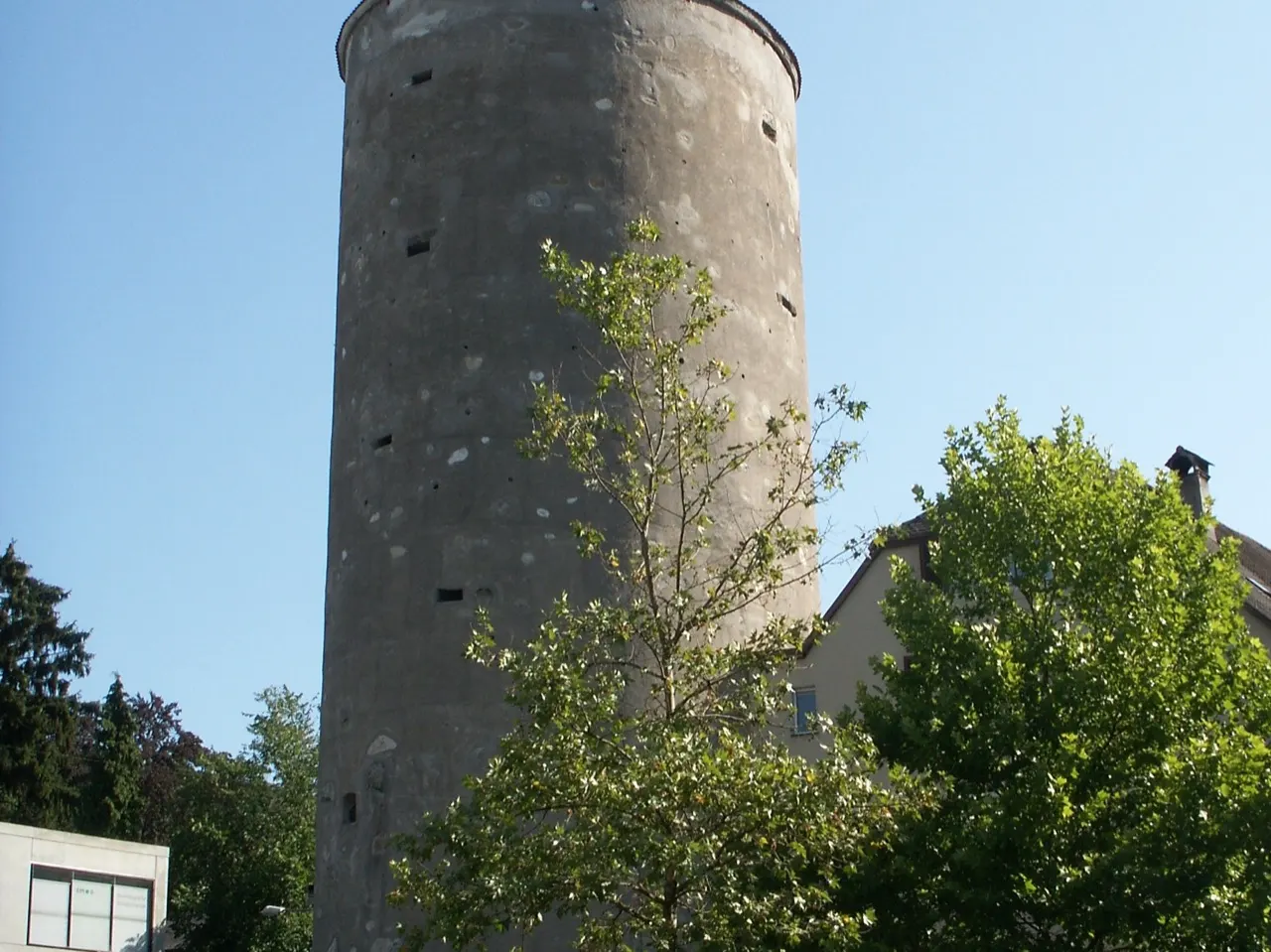
A massive round tower of Feldkirch's town walls, built around 1500, which holds the largest bell in Vorarlberg.

How to get there by public transport

Plan a route to “Katzenturm”

From your location or a typed address — the route is drawn on the 3D map above.

Loading planner…

Katzenturm — Feldkirch
Katzenturm · Welleschik / CC BY-SA 3.0 (Wikimedia Commons)

What it is

The tower was built between 1491 and 1507 as part of the fortifications on the vulnerable north side of the town. Its name is thought to come from the 'Katzen', heavy guns that were placed in it. Since 1857 it has held a bell weighing around 7.5 tonnes, the largest in the province, which is rung on special occasions.

Together with the Churertor, the Mühletor and the Wasserturm, it is one of the surviving towers and gates of the old walls that give Feldkirch its medieval character.

Getting there by bus

The Katzenturm stop right at the tower, and Busplatz next to it, are the hub of Feldkirch's bus network: lines 14, 401 to 409, 414 and 427 stop here. The railway station is about eight minutes' walk to the north.

The old town with the cathedral and the Marktgasse begins right behind the tower.
Frequently asked questions

How do I get to Katzenturm by public transport?

The nearest stops are Feldkirch Busplatz, Feldkirch Katzenturm. Open any of them to see the lines that stop there, or use the Journey Planner for a route from your location to Katzenturm.

What is the nearest stop to Katzenturm?

Feldkirch Busplatz (stop code 48_818_4), about 10 m from Katzenturm. On the stop page you can see all the lines that stop there and live arrival estimates.

Where is Katzenturm located?

Katzenturm is in Feldkirch. You can see its exact location and a 3D view at the top of this page.

How do I get to Katzenturm from another part of the city?

Open the Journey Planner, enter your origin (an address or a stop) and Katzenturm as the destination — you will get the best routes with lines, transfers and departure times based on the timetable.

Other landmarks

Photos: Wikimedia Commons (free/licensed) · 3D view: MapLibre + OpenStreetMap.