
Guide
Klagenfurt Guide
Klagenfurt landmarks in true 3D — and how to reach each by public transport (lines, nearest stops, a planner from your location).
- 5Landmarks
- 5Guides & tips
- KlagenfurtCity
Guides & tips
All guides →Landmarks · 5
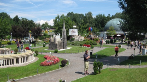 3D ParkMinimundusA miniature park near the Wörthersee with more than 150 models of famous buildings from around the world, built at a scale of 1:25 and set among gardens.Open guide
 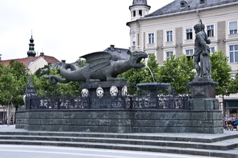 3D LandmarkDragon Fountain (Lindwurmbrunnen)The symbol of Klagenfurt, a winged dragon carved from a single block of stone around 1590, facing a club-wielding Hercules on the city's central square, Neuer Platz.Open guide
 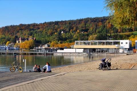 3D BeachWörthersee Lido (Strandbad Klagenfurt)Klagenfurt's large lakeside lido at the eastern tip of the Wörthersee, one of the warmest Alpine lakes, with lawns, piers and the boat landing stage next door.Open guide
 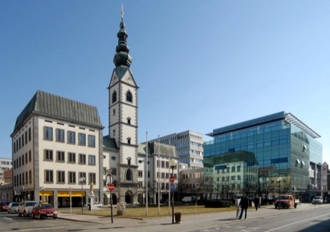 3D Church & monasteryKlagenfurt Cathedral (Dom St. Peter und Paul)A church built by the Protestant estates of Carinthia in the late 16th century, later taken over by the Jesuits and given a lavish baroque interior of stucco and frescoes.Open guide
 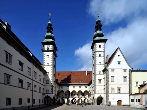 3D HistoryLandhaus & Hall of ArmsThe twin-towered Renaissance seat of the Carinthian parliament, whose Great Hall of Arms is painted with 665 coats of arms of the province's nobility.Open guide
 Frequently asked questions
How do I reach Klagenfurt’s landmarks by public transport?
Open any landmark from the guide — its page shows the nearest stops and a planner that finds a route from your location to it, with lines, transfers and departure times based on the timetable.
Which landmarks does the guide cover?
Klagenfurt’s best-known landmarks — Minimundus, Dragon Fountain (Lindwurmbrunnen), Wörthersee Lido (Strandbad Klagenfurt), Klagenfurt Cathedral (Dom St. Peter und Paul), Landhaus & Hall of Arms — each with a 3D view of the location and directions on how to get there by public transport.
What is the 3D view of a landmark?
An interactive 3D model of the location (buildings and surroundings from OpenStreetMap data) that rotates and tilts. It is not a photo but a graphical view of the place, so you can recognise the area before you set off.
How do I plan a tour of several landmarks?
Use the Journey Planner for a public transport route to each landmark; every landmark page also lists the nearest stops with arrival estimates, so you can easily chain several points into one tour.
Photos: Wikimedia Commons (free/licensed) · 3D view: MapLibre + OpenStreetMap.