
Guide
Krems Guide
Krems landmarks in true 3D — and how to reach each by public transport (lines, nearest stops, a planner from your location).
- 4Landmarks
- 5Guides & tips
- KremsCity
Guides & tips
All guides →Tickets in Austria: single tickets, day passes and the KlimaTicketHow public transport tickets work in Austrian cities: one ticket for bus, tram and train within a network, where to buy it, day and weekly passes, and the nationwide KlimaTicket.Read the guideVienna Airport to the city: S7, CAT, Railjet and busesVienna International Airport at Schwechat is about 18 km from the centre. The choice is between the S7 suburban train, the non-stop City Airport Train, ÖBB trains to the Hauptbahnhof and the Vienna Airport Lines buses.Read the guideVienna U-Bahn, trams and night busesHow to get around Vienna: five U-Bahn lines, one of the largest tram networks in the world, city buses, the NightLine night buses and the all-night U-Bahn on Friday and Saturday nights.Read the guideGetting around Salzburg and InnsbruckSalzburg runs one of the largest trolleybus networks in Western Europe, Innsbruck combines trams and letter-coded buses, and both have regional S-Bahn trains into the mountains and valleys around them.Read the guideRegional buses and trains: Postbus, S-Bahn and ÖBBHow to travel between Austrian towns by public transport – the Postbus and regional bus network, the S-Bahn and ÖBB trains – and how the Intercity section of this site shows departures between them.Read the guide
Landmarks · 4
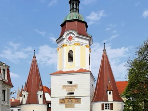 3D LandmarkSteiner TorThe 15th-century town gate of Krems, crowned by a baroque clock tower flanked by two pointed Gothic turrets, and the symbol of the gateway to the Wachau.Open guide
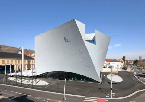 3D MuseumState Gallery of Lower Austria (Landesgalerie Niederösterreich)A striking twisted building on the Krems Kunstmeile, opened in 2019, showing Austrian art from the 18th century to the present from the collections of Lower Austria.Open guide
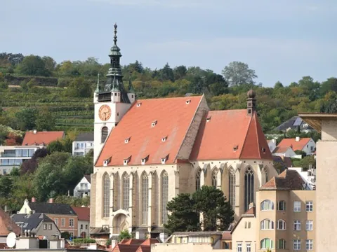 3D Church & monasteryPiarist Church (Piaristenkirche)A late Gothic hall church on the Frauenberg above the old town of Krems, with baroque altar paintings by the Kremser Schmidt and a view over the roofs to the Danube.Open guide
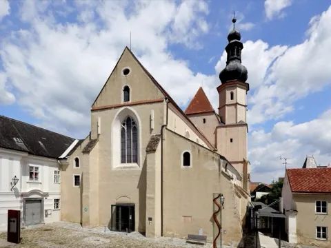 3D Church & monasteryMinorite Church, Stein (Minoritenkirche)An early Gothic friars' church consecrated in 1264 in the old town of Stein, one of the oldest of its kind in Austria, now used for exhibitions and concerts.Open guide
Frequently asked questions
How do I reach Krems’s landmarks by public transport?
Open any landmark from the guide — its page shows the nearest stops and a planner that finds a route from your location to it, with lines, transfers and departure times based on the timetable.
Which landmarks does the guide cover?
Krems’s best-known landmarks — Steiner Tor, State Gallery of Lower Austria (Landesgalerie Niederösterreich), Piarist Church (Piaristenkirche), Minorite Church, Stein (Minoritenkirche) — each with a 3D view of the location and directions on how to get there by public transport.
Photos: Wikimedia Commons (free/licensed) · 3D view: MapLibre + OpenStreetMap.