buses.appCarlow public transport
Loading 3D view…

Carlow Guide

Carlow Castle

Carlow

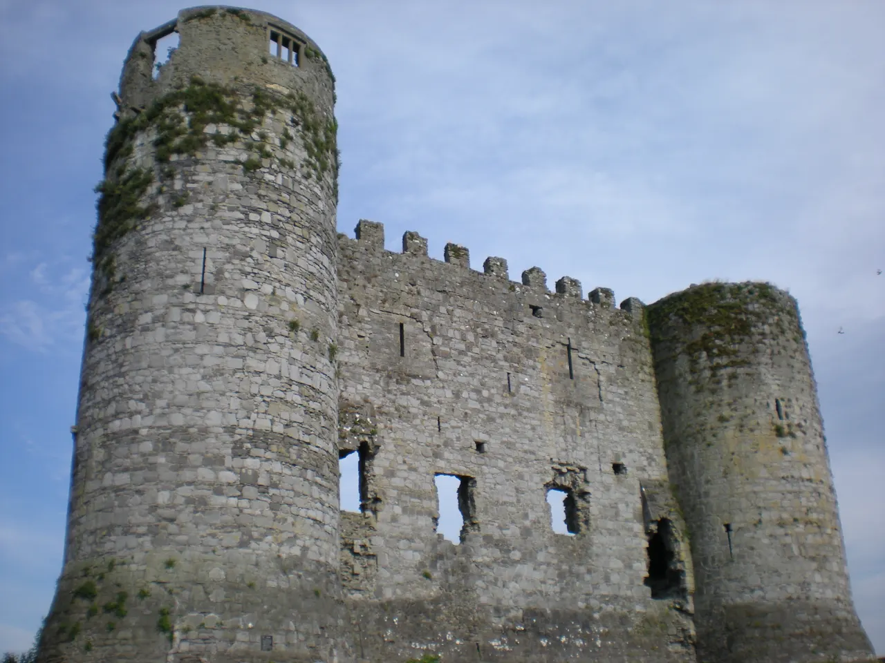
The ruin of a Norman keep of about 1210 on the River Barrow, half of which was blown up in 1814 by a doctor trying to convert it into an asylum.

How to get there by public transport

Lines stopping nearby

Plan a route to “Carlow Castle”

From your location or a typed address — the route is drawn on the 3D map above.

Loading planner…

Carlow Castle — Carlow
Carlow Castle · Age Bosma / CC BY-SA 3.0 (Wikimedia Commons)

What it is

William Marshal's castle was a rectangular keep with a round tower at each corner, a design that became the model for later Irish castles. Two towers and the wall between them survive; the rest fell when Dr Philip Middleton used explosives to enlarge the windows. The ruin stands beside the Barrow and can be viewed from the road and the riverside.

A plaque on the railings tells the story of the unfortunate renovation.

Getting there by bus

The castle is on Castle Hill at the western edge of the town centre, beside Graiguecullen Bridge, a five-minute walk from Tullow Street. Buses through the centre stop at Carlow Castle on Kennedy Avenue and Castle Street.

The Barrow towpath south towards Milford starts on the far bank.
Frequently asked questions

How do I get to Carlow Castle by public transport?

The nearest stops are Carlow Cstl, Maryborough Street, Kennedy Avenue. Open any of them to see the lines that stop there, or use the Journey Planner for a route from your location to Carlow Castle.

What is the nearest stop to Carlow Castle?

Carlow Cstl (stop code 111281), about 40 m from Carlow Castle. On the stop page you can see all the lines that stop there and live arrival estimates.

Where is Carlow Castle located?

Carlow Castle is in Carlow. You can see its exact location and a 3D view at the top of this page.

How do I get to Carlow Castle from another part of the city?

Open the Journey Planner, enter your origin (an address or a stop) and Carlow Castle as the destination — you will get the best routes with lines, transfers and departure times based on the timetable.

Other landmarks

Photos: Wikimedia Commons (free/licensed) · 3D view: MapLibre + OpenStreetMap.