buses.appWexford public transport
Loading 3D view…

Wexford Guide

The Bull Ring

Wexford

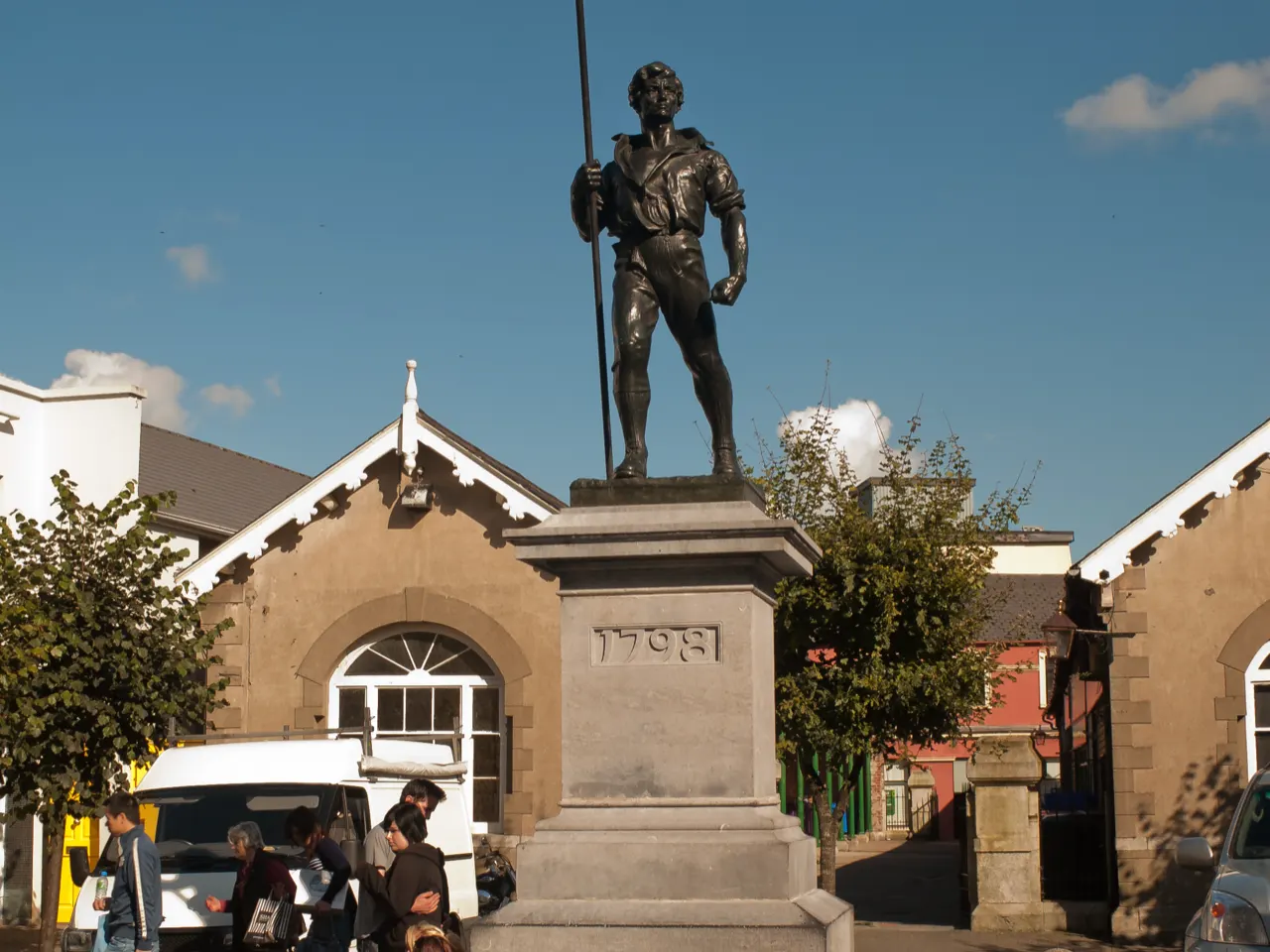
Wexford's old market square, where Norman nobles once baited bulls and where the bronze Pikeman of 1905 commemorates the rebels of 1798.

How to get there by public transport

Lines stopping nearby

Plan a route to “The Bull Ring”

From your location or a typed address — the route is drawn on the 3D map above.

Loading planner…

The Bull Ring — Wexford
The Bull Ring · Andreas F. Borchert / CC BY-SA 4.0 (Wikimedia Commons)

What it is

The square takes its name from the bull-baiting practised by the butchers' guild from the 1620s. In 1649 it was the scene of Cromwell's massacre of the townspeople, and in 1798 the rebels declared a republic here. Oliver Sheppard's Pikeman statue is the town's emblem, and a market still fills the square on Fridays.

Main Street, one of the narrowest high streets in Europe, runs off the square in both directions.

Getting there by bus

The Bull Ring is just off the Quay in the centre of town, three minutes' walk from Custom House Quay stop and seven from the bus and railway station at Redmond Square.

The National Opera House is two minutes uphill on High Street.
Frequently asked questions

How do I get to The Bull Ring by public transport?

The nearest stops are Custom Hse Quay, Wexford Stn, Crescent Quay. Open any of them to see the lines that stop there, or use the Journey Planner for a route from your location to The Bull Ring.

What is the nearest stop to The Bull Ring?

Custom Hse Quay (stop code 14690), about 160 m from The Bull Ring. On the stop page you can see all the lines that stop there and live arrival estimates.

Where is The Bull Ring located?

The Bull Ring is in Wexford. You can see its exact location and a 3D view at the top of this page.

How do I get to The Bull Ring from another part of the city?

Open the Journey Planner, enter your origin (an address or a stop) and The Bull Ring as the destination — you will get the best routes with lines, transfers and departure times based on the timetable.

Other landmarks

Photos: Wikimedia Commons (free/licensed) · 3D view: MapLibre + OpenStreetMap.