
Guide
Wellington Guide
Wellington landmarks in true 3D — and how to reach each by public transport (lines, nearest stops, a planner from your location).
- 12Landmarks
- 5Guides & tips
- WellingtonCity
Guides & tips
All guides →Landmarks · 12
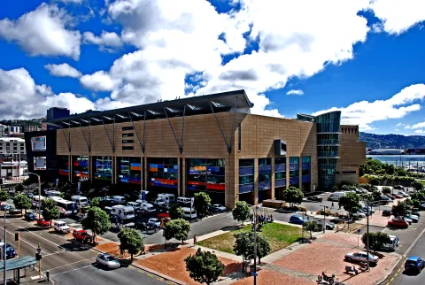 3D MuseumMuseum of New Zealand Te Papa TongarewaNew Zealand's national museum and art gallery, opened in 1998 on the Wellington waterfront, with collections ranging from Māori taonga and natural history to the colossal squid and the national art collection.Open guide
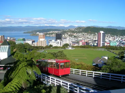 3D LandmarkWellington Cable CarA funicular railway opened in 1902 that climbs 120 metres from Lambton Quay to Kelburn, where the upper terminus has a lookout over the city, the Cable Car Museum and an entrance to the Botanic Garden.Open guide
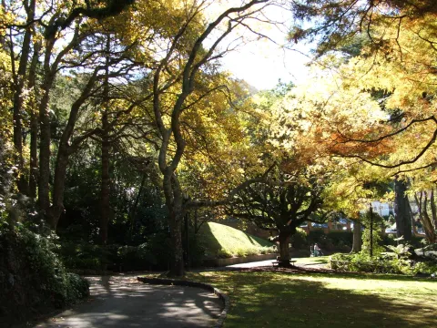 3D ParkWellington Botanic GardenA 25-hectare garden on the hillside between Thorndon and Kelburn, established in 1868, combining native forest, exotic plantings, the Lady Norwood Rose Garden and the Begonia House.Open guide
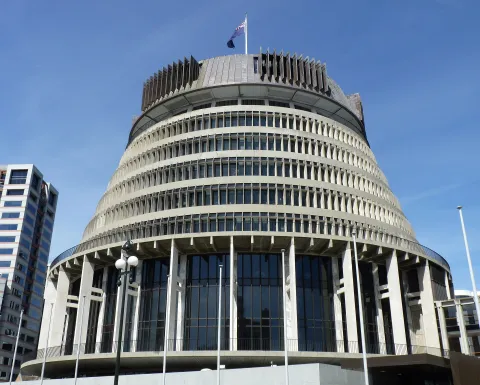 3D LandmarkThe BeehiveThe round, stepped Executive Wing of New Zealand's Parliament Buildings, designed by Sir Basil Spence and completed in 1981, which houses the offices of government ministers and the Cabinet room.Open guide
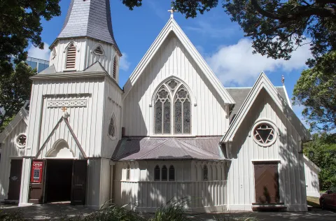 3D Church & monasteryOld St Paul'sA Gothic Revival church built in 1865-66 from native New Zealand timbers in Thorndon, the pro-cathedral of the Anglican Diocese of Wellington until 1964 and now a heritage site and venue.Open guide
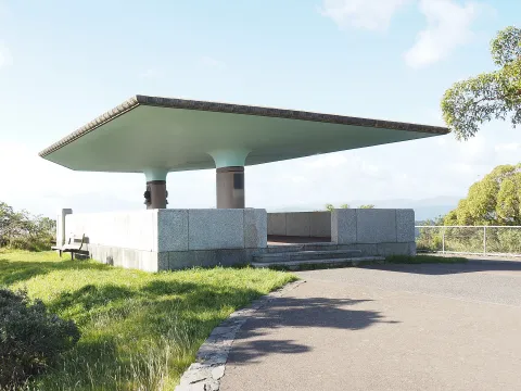 3D NatureMatairangi / Mount VictoriaA 196-metre hill on the Town Belt just east of central Wellington, whose summit lookout gives a full panorama of the city, harbour, airport and Miramar Peninsula.Open guide
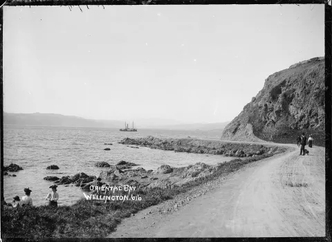 3D BeachOriental BayWellington's inner-city beach, a curve of sand along Oriental Parade lined with Norfolk pines, apartment buildings and cafés, with the Carter Fountain offshore and views across the harbour.Open guide
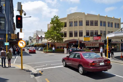 3D LandmarkCuba StreetOne of Wellington's best-known streets, with a pedestrian mall since 1969, the Bucket Fountain and a protected streetscape of Victorian and Edwardian shops filled with cafés, bars, record shops and second-hand stores.Open guide
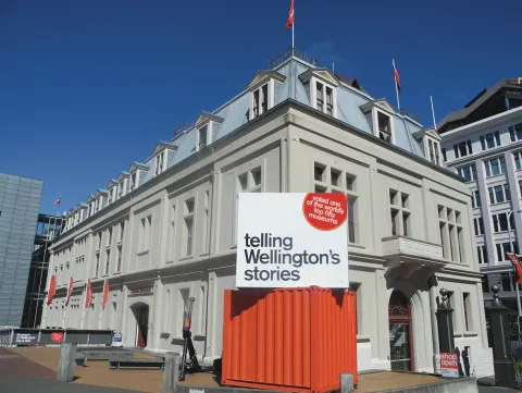 3D MuseumWellington MuseumA museum of the city's social and maritime history housed in the 1892 Bond Store on Queens Wharf, with displays on the port, the Wahine disaster and Māori legends of Wellington Harbour.Open guide
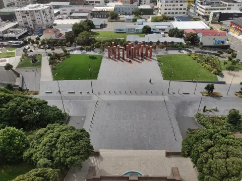 3D HistoryPukeahu National War Memorial ParkNew Zealand's national place of remembrance in Mount Cook, opened in 2015 for the Gallipoli centenary in front of the National War Memorial carillon, with memorials from Australia, the United Kingdom, France, Turkey and other nations.Open guide
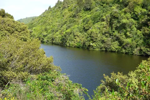 3D NatureZealandia Te Māra a TāneA 225-hectare urban ecosanctuary in the Karori valley, enclosed by an 8.6-kilometre predator-proof fence since 1999, where native birds and reptiles such as kākā, takahē and tuatara live close to the city.Open guide
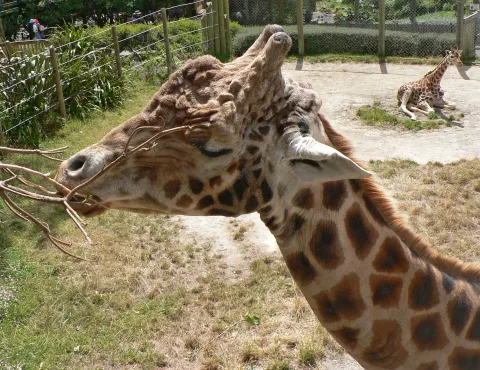 3D ParkWellington ZooNew Zealand's oldest public zoo, founded in 1906 on a hillside in the Town Belt at Newtown, with around 80 species and an animal hospital, The Nest Te Kōhanga, that treats injured native wildlife.Open guide
Frequently asked questions
How do I reach Wellington’s landmarks by public transport?
Open any landmark from the guide — its page shows the nearest stops and a planner that finds a route from your location to it, with lines, transfers and departure times based on the timetable.
Which landmarks does the guide cover?
Wellington’s best-known landmarks — Museum of New Zealand Te Papa Tongarewa, Wellington Cable Car, Wellington Botanic Garden, The Beehive, Old St Paul's — each with a 3D view of the location and directions on how to get there by public transport.
What is the 3D view of a landmark?
An interactive 3D model of the location (buildings and surroundings from OpenStreetMap data) that rotates and tilts. It is not a photo but a graphical view of the place, so you can recognise the area before you set off.
How do I plan a tour of several landmarks?
Use the Journey Planner for a public transport route to each landmark; every landmark page also lists the nearest stops with arrival estimates, so you can easily chain several points into one tour.
Photos: Wikimedia Commons (free/licensed) · 3D view: MapLibre + OpenStreetMap.