
Guide
Christchurch Guide
Christchurch landmarks in true 3D — and how to reach each by public transport (lines, nearest stops, a planner from your location).
- 12Landmarks
- 5Guides & tips
- ChristchurchCity
Guides & tips
All guides →Landmarks · 12
 3D SquareCathedral SquareThe central square of Christchurch, laid out around ChristChurch Cathedral, whose earthquake-damaged Gothic Revival building is being restored while the central library and the heritage tram frame the open space.Open guide
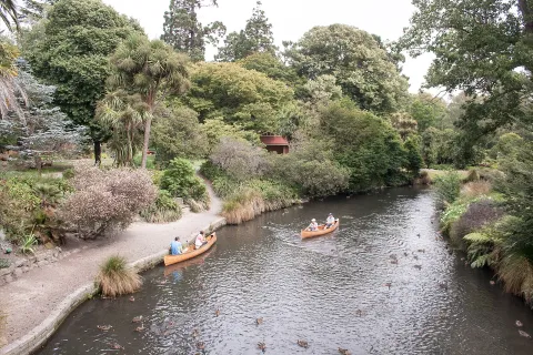 3D ParkChristchurch Botanic GardensA 21-hectare garden founded in 1863 inside a loop of the Avon River (Ōtākaro), next to Hagley Park on the western edge of the central city, with glasshouses, rose gardens and heritage trees.Open guide
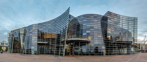 3D MuseumChristchurch Art Gallery Te Puna o WaiwhetūThe city's public art museum, opened in 2003 in a glass-fronted building on Worcester Boulevard and Montreal Street, with a collection of New Zealand and international art and changing exhibitions.Open guide
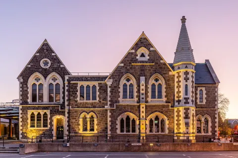 3D HistoryThe Arts Centre Te Matatiki Toi OraA complex of Gothic Revival stone buildings on Worcester Boulevard, built from 1877 as Canterbury College and now home to galleries, museums, studios, cafés and a weekend market.Open guide
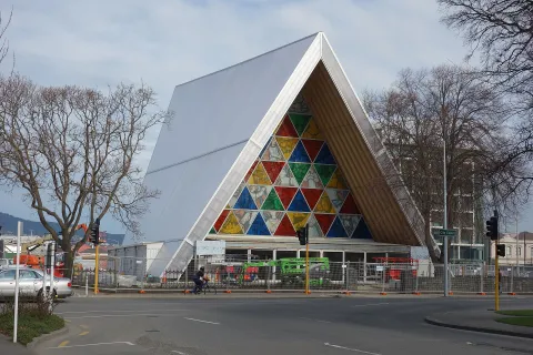 3D Church & monasteryCardboard CathedralThe Transitional Cathedral of the Anglican diocese, designed by Japanese architect Shigeru Ban and opened in 2013 on Latimer Square, built largely from large cardboard tubes, timber and shipping containers.Open guide
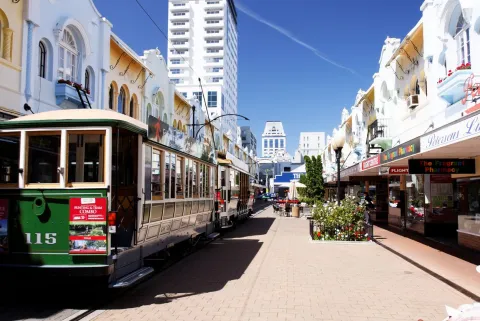 3D LandmarkNew Regent StreetA short pedestrian street of pastel-coloured Spanish Mission shopfronts, built in 1931–32 and now lined with cafés and small shops, with the heritage tram running down its centre.Open guide
 3D HistoryCanterbury Earthquake National Memorial (Oi Manawa)The national memorial to the 185 people killed in the Christchurch earthquake of 22 February 2011, set on both banks of the Avon River (Ōtākaro) just downstream of the Montreal Street bridge.Open guide
 3D LandmarkTūrangaChristchurch's central library, a five-storey building on the corner of Cathedral Square opened in 2018, the largest public library in the South Island.Open guide
 3D MuseumInternational Antarctic CentreA visitor attraction at Christchurch Airport, on the campus that serves the New Zealand, United States and Italian Antarctic programmes, with a simulated polar storm, rescued little blue penguins and all-terrain vehicle rides.Open guide
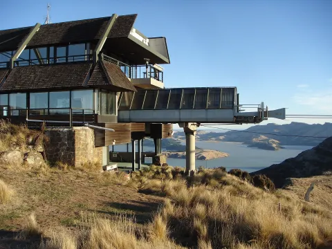 3D NatureChristchurch GondolaA cable car rising about one kilometre from Heathcote Valley to a summit station on Mount Cavendish in the Port Hills, with views over the city, Lyttelton Harbour, the Canterbury Plains and the Southern Alps.Open guide
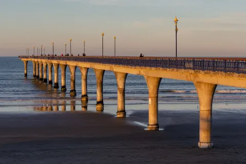 3D BeachNew Brighton PierA 300-metre reinforced concrete pier stretching into Pegasus Bay from New Brighton Beach, opened in 1997 on the site of a timber pier from 1894, popular for walking and fishing.Open guide
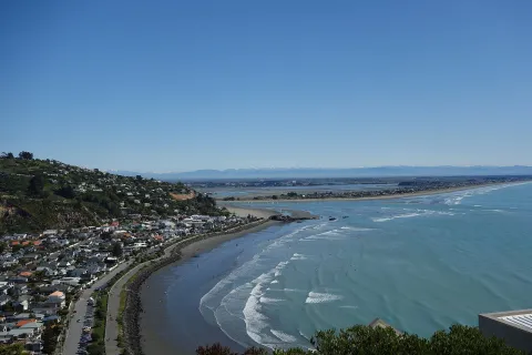 3D BeachSumner BeachA seaside suburb and sandy beach at the foot of the Port Hills, south-east of central Christchurch, known for Cave Rock, its esplanade and views across the estuary mouth to Pegasus Bay.Open guide
Frequently asked questions
How do I reach Christchurch’s landmarks by public transport?
Open any landmark from the guide — its page shows the nearest stops and a planner that finds a route from your location to it, with lines, transfers and departure times based on the timetable.
Which landmarks does the guide cover?
Christchurch’s best-known landmarks — Cathedral Square, Christchurch Botanic Gardens, Christchurch Art Gallery Te Puna o Waiwhetū, The Arts Centre Te Matatiki Toi Ora, Cardboard Cathedral — each with a 3D view of the location and directions on how to get there by public transport.
What is the 3D view of a landmark?
An interactive 3D model of the location (buildings and surroundings from OpenStreetMap data) that rotates and tilts. It is not a photo but a graphical view of the place, so you can recognise the area before you set off.
How do I plan a tour of several landmarks?
Use the Journey Planner for a public transport route to each landmark; every landmark page also lists the nearest stops with arrival estimates, so you can easily chain several points into one tour.
Photos: Wikimedia Commons (free/licensed) · 3D view: MapLibre + OpenStreetMap.