buses.appChristchurch public transport
Loading 3D view…

Christchurch Guide

Sumner Beach

Christchurch

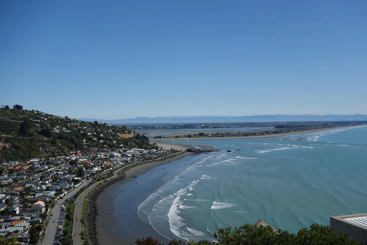
A seaside suburb and sandy beach at the foot of the Port Hills, south-east of central Christchurch, known for Cave Rock, its esplanade and views across the estuary mouth to Pegasus Bay.

How to get there by public transport

Lines stopping nearby

Plan a route to “Sumner Beach”

From your location or a typed address — the route is drawn on the 3D map above.

Loading planner…

Sumner Beach — Christchurch
Sumner Beach · Schwede66 / CC BY-SA 4.0 (Wikimedia Commons)

What it is

Sumner lies where the Port Hills meet the sea, beside the mouth of the Avon Heathcote Estuary. Named after John Bird Sumner, Archbishop of Canterbury, it grew from the 19th century as a seaside resort for city residents and was a separate borough until it joined Christchurch in 1945.

The beach is a long curve of sand backed by an esplanade, cafés and the village centre on Marriner Street. Its best-known feature is Cave Rock (Tuawera), a volcanic outcrop on the sand with a sea cave that can be walked through at low tide. Surfers use the eastern end towards Scarborough, and walking tracks lead up onto the headland and the Port Hills.

Getting there by bus

Nayland St near Hardwicke St (stop 30642), about 140 m from the beach, and Nayland St near Menzies St (stop 30626), around 170 m away, are both served by route 3 (Airport/Sumner).

Route 3 runs along the coast from the central city, so it is the direct way to reach Sumner; Nayland St near Head St (stop 42793) and Nayland St near Stoke St (stop 30657) on the same route are about 4 minutes' walk away.

Frequently asked questions

How do I get to Sumner Beach by public transport?

The nearest stops are Nayland St near Hardwicke St, Nayland St near Menzies St, Nayland St near Stoke St. Open any of them to see the lines that stop there, or use the Journey Planner for a route from your location to Sumner Beach.

What is the nearest stop to Sumner Beach?

Nayland St near Hardwicke St (stop code 30642), about 140 m from Sumner Beach. On the stop page you can see all the lines that stop there and live arrival estimates.

Where is Sumner Beach located?

Sumner Beach is in Christchurch. You can see its exact location and a 3D view at the top of this page.

How do I get to Sumner Beach from another part of the city?

Open the Journey Planner, enter your origin (an address or a stop) and Sumner Beach as the destination — you will get the best routes with lines, transfers and departure times based on the timetable.

Other landmarks

Photos: Wikimedia Commons (free/licensed) · 3D view: MapLibre + OpenStreetMap.