
Guide
Vienna Guide
Vienna landmarks in true 3D — and how to reach each by public transport (lines, nearest stops, a planner from your location).
- 14Landmarks
- 5Guides & tips
- ViennaCity
Guides & tips
All guides →Landmarks · 14
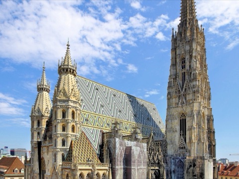 3D Church & monasterySt. Stephen's Cathedral (Stephansdom)Vienna's Gothic cathedral and the symbol of the city, with its 136-metre south tower and the patterned tile roof rising above Stephansplatz in the very centre of the old town.Open guide
 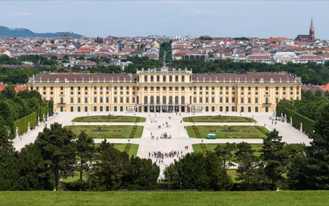 3D HistorySchönbrunn PalaceThe Habsburgs' baroque summer residence in Hietzing, with more than 1,400 rooms, formal gardens climbing to the Gloriette and the world's oldest zoo still in operation.Open guide
 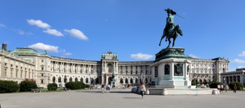 3D HistoryHofburg Imperial PalaceThe Habsburgs' winter residence for more than six centuries, a city within the city of courtyards, museums and ceremonial halls between Michaelerplatz and Heldenplatz.Open guide
 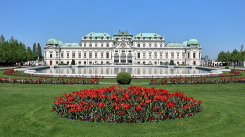 3D MuseumBelvedere PalaceTwo baroque palaces built for Prince Eugene of Savoy and linked by terraced gardens, now an art museum best known for Gustav Klimt's The Kiss.Open guide
 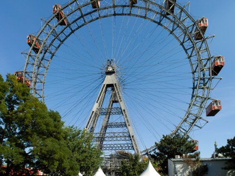 3D LandmarkPrater & the Giant Ferris Wheel (Riesenrad)Vienna's great public park and its fairground, watched over by the Riesenrad, the Ferris wheel built in 1897 that became famous from the film The Third Man.Open guide
 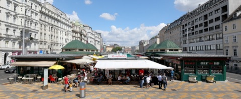 3D MarketNaschmarktVienna's best-known market, a mile-long row of food stalls, delis and small restaurants on the Wienzeile between Karlsplatz and Kettenbrückengasse.Open guide
 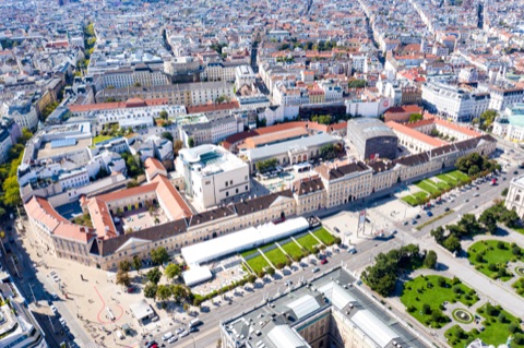 3D MuseumMuseumsQuartierOne of the largest cultural districts in the world, set in the former imperial stables behind the Ring, with the Leopold Museum, mumok and Kunsthalle Wien around open courtyards.Open guide
 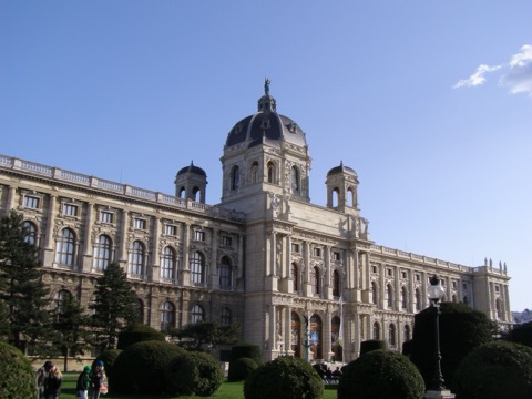 3D MuseumKunsthistorisches Museum (Museum of Fine Arts)The Habsburgs' art collection in a domed palace on the Ring, with the world's largest group of paintings by Pieter Bruegel the Elder and a celebrated cabinet of curiosities.Open guide
 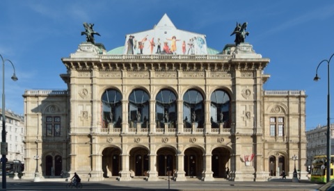 3D LandmarkVienna State Opera (Staatsoper)One of the world's great opera houses, opened on the Ring in 1869, with a different performance almost every evening of the season and the famous Opera Ball each winter.Open guide
 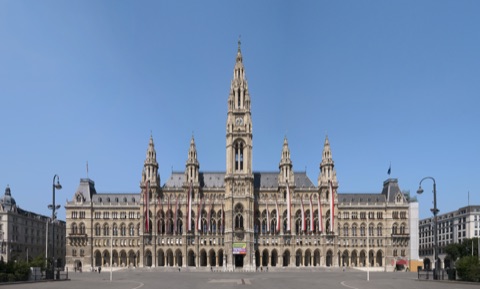 3D LandmarkVienna City Hall (Rathaus)The neo-Gothic seat of the mayor and city council on the Ring, whose square hosts the Christmas market, an ice rink in winter and a free film festival in summer.Open guide
 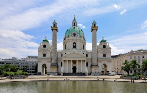 3D Church & monasterySt. Charles Church (Karlskirche)Vienna's finest baroque church, with a great green dome flanked by two columns inspired by Trajan's Column in Rome, reflected in the pool on Karlsplatz.Open guide
 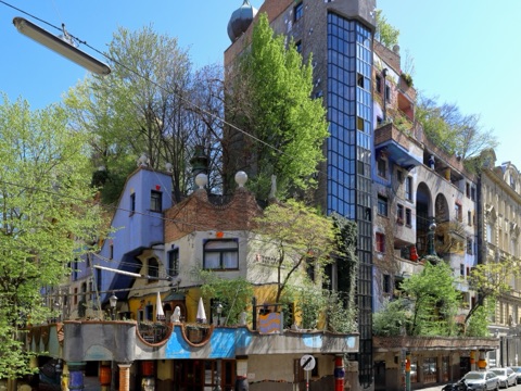 3D LandmarkHundertwasserhausA block of council flats in Landstraße designed by the artist Friedensreich Hundertwasser, with colourful uneven facades, onion domes and trees growing out of the windows.Open guide
 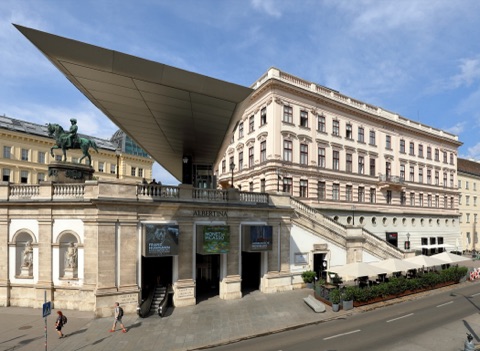 3D MuseumAlbertinaA Habsburg palace on the old city bastion that holds one of the world's great collections of prints and drawings, from Dürer's Young Hare to Monet and Picasso.Open guide
 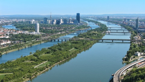 3D NatureDanube Island (Donauinsel)A 21-kilometre-long island between the Danube and the New Danube, Vienna's summer playground for swimming, cycling and picnics, and home to the huge Donauinselfest.Open guide
 Frequently asked questions
How do I reach Vienna’s landmarks by public transport?
Open any landmark from the guide — its page shows the nearest stops and a planner that finds a route from your location to it, with lines, transfers and departure times based on the timetable.
Which landmarks does the guide cover?
Vienna’s best-known landmarks — St. Stephen's Cathedral (Stephansdom), Schönbrunn Palace, Hofburg Imperial Palace, Belvedere Palace, Prater & the Giant Ferris Wheel (Riesenrad) — each with a 3D view of the location and directions on how to get there by public transport.
What is the 3D view of a landmark?
An interactive 3D model of the location (buildings and surroundings from OpenStreetMap data) that rotates and tilts. It is not a photo but a graphical view of the place, so you can recognise the area before you set off.
How do I plan a tour of several landmarks?
Use the Journey Planner for a public transport route to each landmark; every landmark page also lists the nearest stops with arrival estimates, so you can easily chain several points into one tour.
Photos: Wikimedia Commons (free/licensed) · 3D view: MapLibre + OpenStreetMap.