buses.appPerth public transport
Loading 3D view…

Perth Guide

Elizabeth Quay

Perth

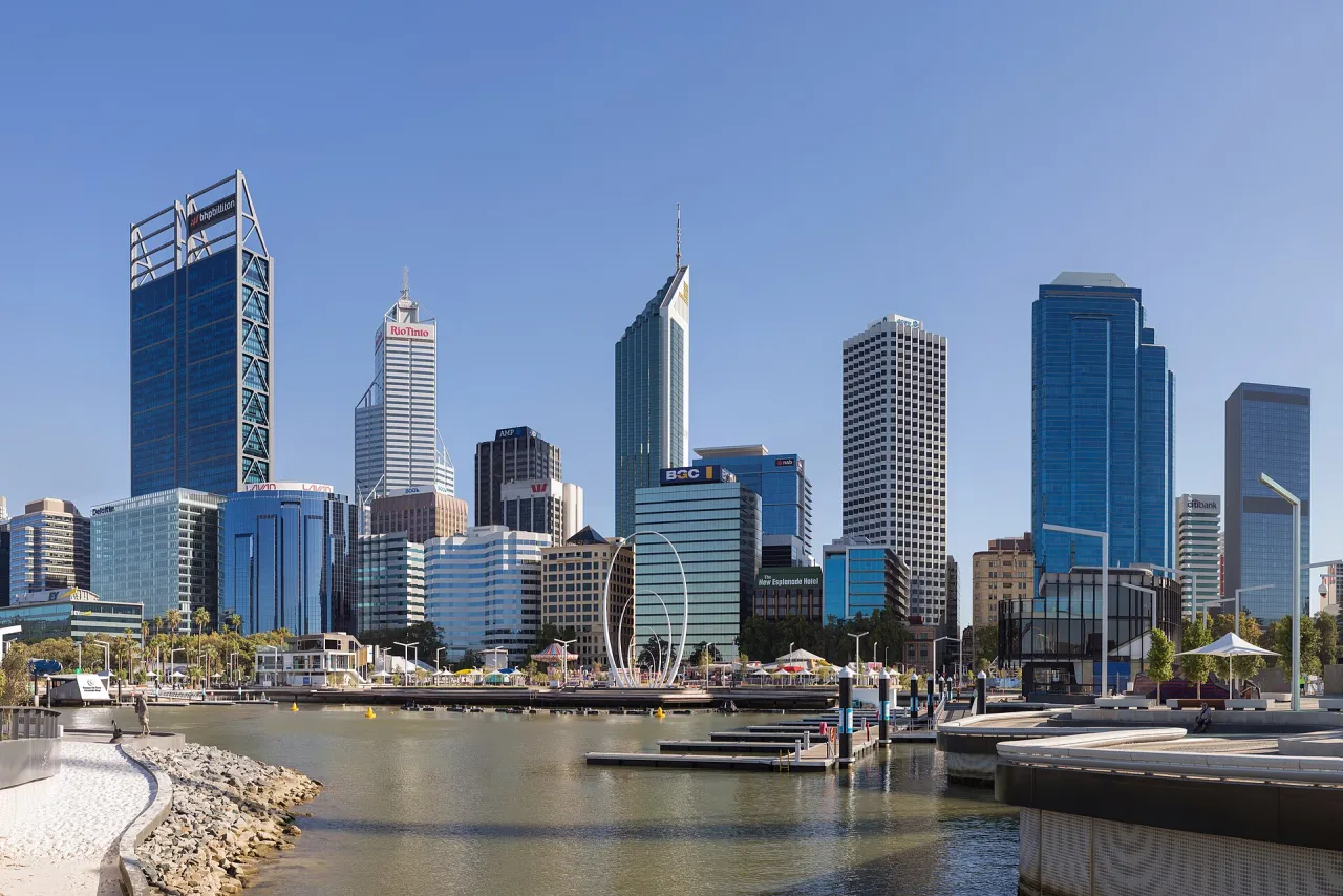
A waterfront precinct on the Swan River at the foot of the city centre, opened in 2016 around a new inlet with promenades, a pedestrian bridge and a ferry jetty.

How to get there by public transport

Lines stopping nearby

Plan a route to “Elizabeth Quay”

From your location or a typed address — the route is drawn on the 3D map above.

Loading planner…

Elizabeth Quay — Perth
Elizabeth Quay · Samuel Wiki / CC BY 4.0 (Wikimedia Commons)

What it is

The quay reconnected the central business district with the river, which had long been cut off by roads and lawns. A curved pedestrian and cycle bridge spans the inlet, and a small island sits at its centre. Spanda, a tall sculpture of white arcs, and the water playground are popular meeting points.

From here the riverside path leads west towards Kings Park and east to Barrack Square with the Bell Tower.

Getting there by bus

Elizabeth Quay station on the Mandurah and Yanchep lines is right next to the quay, and the Elizabeth Quay Bus Station beside it is served by the free Blue CAT and by routes such as 950 and 980. Ferries to Mends Street in South Perth leave from the Elizabeth Quay Jetty.

The Blue CAT also stops at Barrack Square, a few minutes' walk east along the water.
Frequently asked questions

How do I get to Elizabeth Quay by public transport?

The nearest stops are Ferry Route Elizabeth Quay Jetty, Elizabeth Quay Stn Platform 2, Elizabeth Quay Stn Platform 1. Open any of them to see the lines that stop there, or use the Journey Planner for a route from your location to Elizabeth Quay.

What is the nearest stop to Elizabeth Quay?

Ferry Route Elizabeth Quay Jetty (stop code 99997), about 120 m from Elizabeth Quay. On the stop page you can see all the lines that stop there and live arrival estimates.

Where is Elizabeth Quay located?

Elizabeth Quay is in Perth. You can see its exact location and a 3D view at the top of this page.

How do I get to Elizabeth Quay from another part of the city?

Open the Journey Planner, enter your origin (an address or a stop) and Elizabeth Quay as the destination — you will get the best routes with lines, transfers and departure times based on the timetable.

Other landmarks

Photos: Wikimedia Commons (free/licensed) · 3D view: MapLibre + OpenStreetMap.