
Guide
Brisbane Guide
Brisbane landmarks in true 3D — and how to reach each by public transport (lines, nearest stops, a planner from your location).
- 13Landmarks
- 5Guides & tips
- BrisbaneCity
Guides & tips
All guides →Landmarks · 13
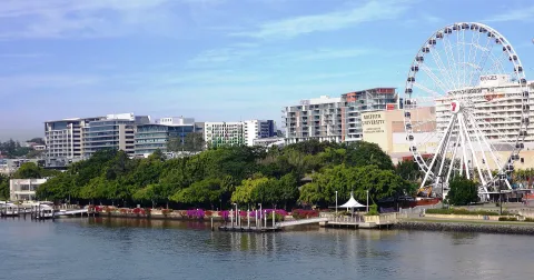 3D ParkSouth Bank ParklandsBrisbane's riverside park on the former site of World Expo 88, with a free man-made swimming lagoon, rainforest walks and a long bougainvillea arbour opposite the city centre.Open guide
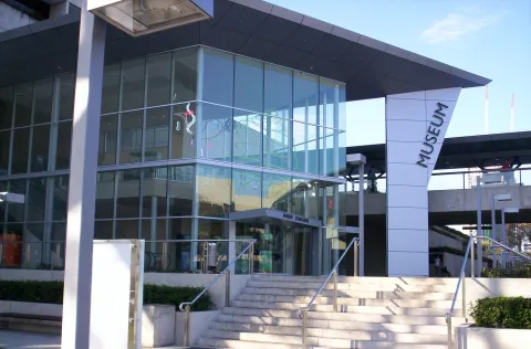 3D MuseumQueensland MuseumQueensland's state museum of natural history and cultural heritage, part of the Queensland Cultural Centre at South Bank, with dinosaurs, wildlife and First Nations collections.Open guide
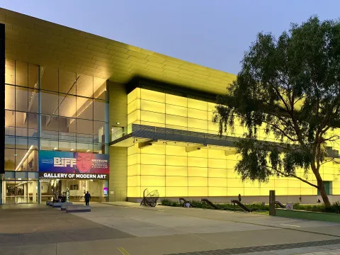 3D MuseumGallery of Modern Art (GOMA)Australia's largest gallery of modern and contemporary art, opened in 2006 on Kurilpa Point beside the Brisbane River as the sister institution of the Queensland Art Gallery.Open guide
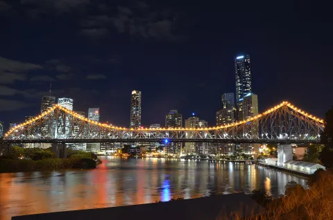 3D LandmarkStory BridgeBrisbane's steel cantilever bridge, opened in 1940, which links Fortitude Valley with Kangaroo Point high above the river and is the best-known image of the city.Open guide
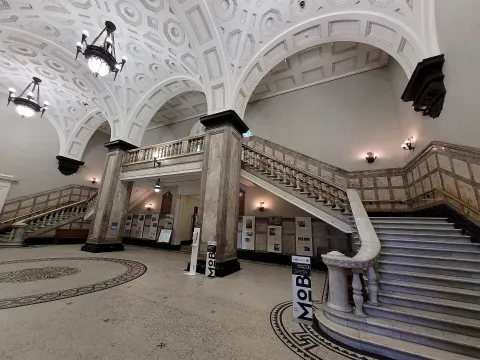 3D LandmarkBrisbane City HallThe sandstone city hall completed in 1930 on King George Square, with its clock tower, a grand concert hall and the Museum of Brisbane on the top floor.Open guide
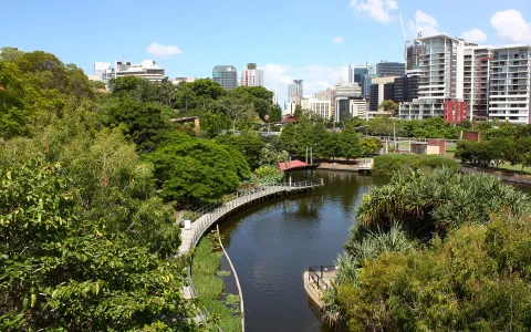 3D ParkRoma Street ParklandA landscaped subtropical garden on the edge of the city centre, laid out on a former railway goods yard and opened in 2001, with lakes, rainforest paths and formal flower beds.Open guide
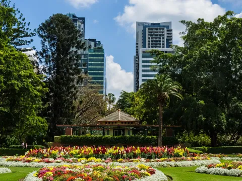 3D ParkCity Botanic GardensBrisbane's original botanic garden on Gardens Point, a bend of the river beside the city centre, with old trees, lawns, ponds and a mangrove boardwalk.Open guide
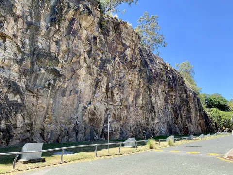 3D NatureKangaroo Point CliffsVolcanic rock cliffs above the Brisbane River opposite the city centre, shaped by quarrying in the nineteenth century and now a park with views of the skyline and a popular climbing site.Open guide
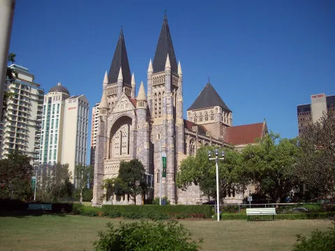 3D Church & monasterySt John's CathedralBrisbane's Anglican cathedral on Ann Street, a Gothic Revival church begun in 1906 and completed only in 2009, more than a century later.Open guide
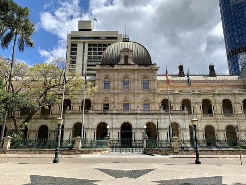 3D HistoryParliament HouseThe seat of the Queensland Parliament at the corner of George and Alice streets, a French Renaissance-style sandstone building opened in 1868 beside the City Botanic Gardens.Open guide
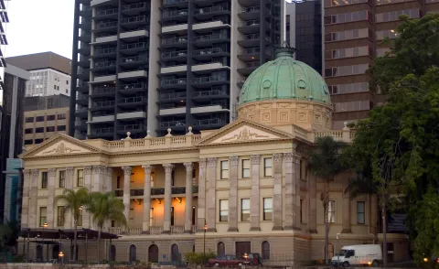 3D HistoryCustoms HouseThe 1889 customs house on the riverfront at Petrie Bight, with its copper dome and colonnades, now a venue and restaurant owned by the University of Queensland.Open guide
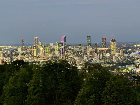 3D NatureMount Coot-tha Summit LookoutThe lookout at the top of Mount Coot-tha, the forested hill west of the city, with the widest view in Brisbane over the city centre, the river and on clear days to Moreton Bay.Open guide
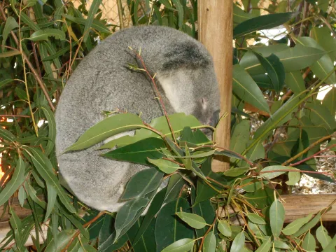 3D NatureLone Pine Koala SanctuaryA wildlife park in the western suburb of Fig Tree Pocket, opened in 1927 and regarded as the world's oldest koala sanctuary, where koalas, kangaroos and other Australian animals can be seen up close.Open guide
Frequently asked questions
How do I reach Brisbane’s landmarks by public transport?
Open any landmark from the guide — its page shows the nearest stops and a planner that finds a route from your location to it, with lines, transfers and departure times based on the timetable.
Which landmarks does the guide cover?
Brisbane’s best-known landmarks — South Bank Parklands, Queensland Museum, Gallery of Modern Art (GOMA), Story Bridge, Brisbane City Hall — each with a 3D view of the location and directions on how to get there by public transport.
What is the 3D view of a landmark?
An interactive 3D model of the location (buildings and surroundings from OpenStreetMap data) that rotates and tilts. It is not a photo but a graphical view of the place, so you can recognise the area before you set off.
How do I plan a tour of several landmarks?
Use the Journey Planner for a public transport route to each landmark; every landmark page also lists the nearest stops with arrival estimates, so you can easily chain several points into one tour.
Photos: Wikimedia Commons (free/licensed) · 3D view: MapLibre + OpenStreetMap.